Example of a Back Door Storm
December 22 to 23, 2007
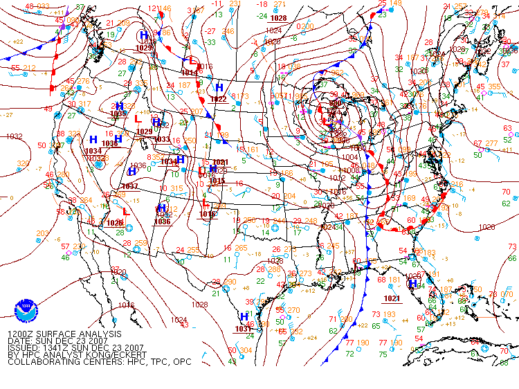
The following sequence of images shows a low pressure center in extreme North-Central Texas that moved northeast to Northern Illinois, then Northeast Wisconsin, then northwest into the Western Upper Peninsula of Michigan. The storm produced snow in Duluth, MN from late Saturday evening December 22 through Sunday afternoon December 23. The heaviest snow fell from the late overnight morning hours of Sunday into the early afternoon.
Surface maps from the National Weather Service Weather Prediction Center's surface map archive
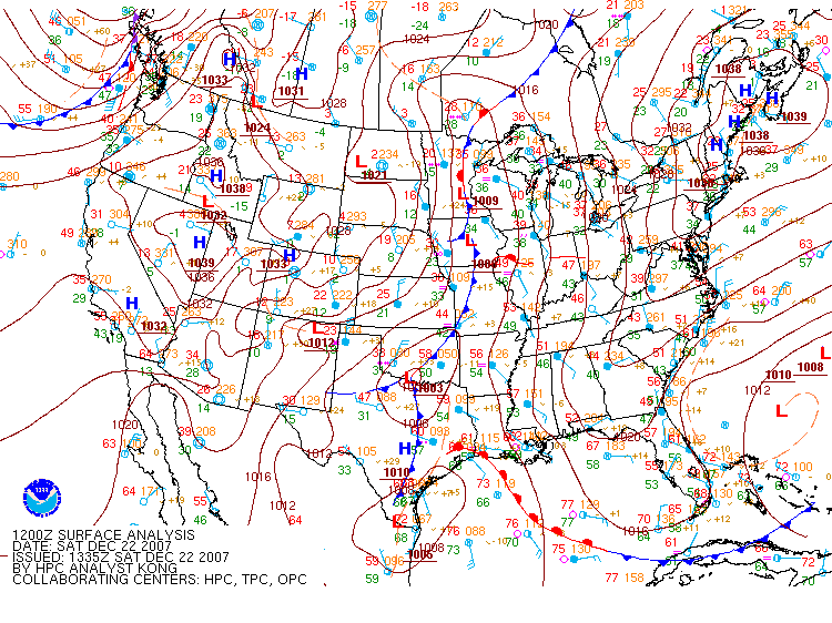
6:00 AM CST, December 22, 2007 (12:00 UTC, December 22)
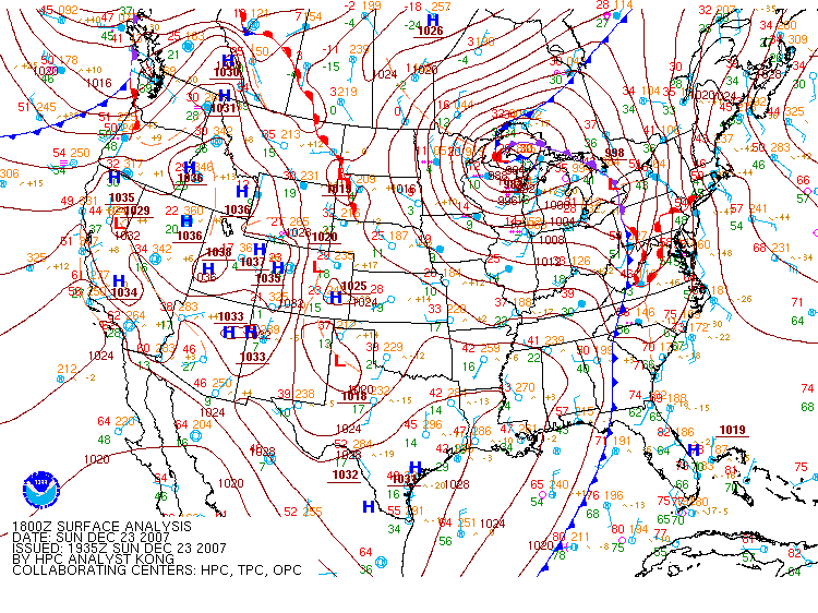
12:00 Noon CST, December 22, 2007 (18:00 UTC, December 22)

6:00 PM CST, December 22, 2007 (00:00 UTC, December 23)
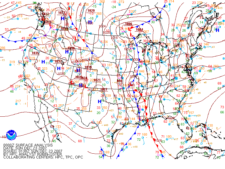
12:00 AM CST, December 23, 2007 (06:00 UTC, December 23)
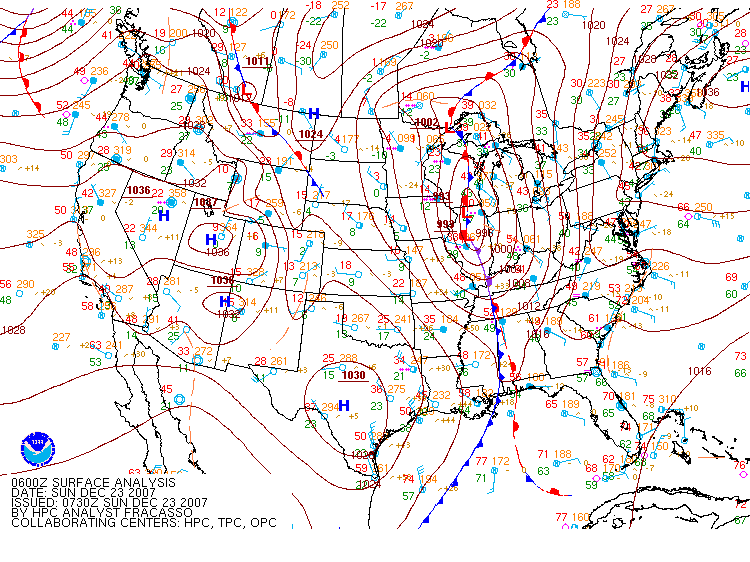
6:00 AM CST, December 23, 2007 (12:00 UTC, December 23)
12:00 Noon CST, December 23, 2007 (18:00 UTC, December 23)