A storm system stalled in Minnesota and Wisconsin and produced two rounds of heavy snow that affected mainly east central Minnesota and west central to northwest Wisconsin. The first round of heavy snow in Duluth and the city of Superior, Wisconsin fell late Tuesday afternoon, January 3 between 4 PM and 6 PM. Snowfall rates around an inch per hour dropped a quick 1 1/2 to 3 inches of snow in that two hour period. Personal measurement at 6 PM was 2 1/4 inches. Much lighter and sometimes intermittent snow continued into the evening. Snow increased in coverage and intensity again late in the overnight to early daylight morning on Wednesday, January 3. Some of the development occurred overhead but the main area of snow moved in from the south as bands of snow continued to wrap north around the storm system that was at that time centered at the surface in southeast Minnesota and northeast Iowa. The upper level (500 mb) circulation of the storm was centered a little farther west over south-central Minnesota and north-central Iowa. Snow, moderate to heavy at times, fell through the morning and afternoon then shifted back to the south during the evening. Most of the snow that lingered beyond midnight January 5 fell to the south of Duluth and Superior and weakened to very light snow and flurries that lingered into the early daylight morning hours.
Throughout the storm, the northern edge of the accumulating snow persisted in Minnesota from half way between Duluth and the Iron Range to just north of Two Harbors. The strongest gradient in snow totals extended through Duluth with amounts ranging from around 5 inches several miles inland near the Duluth International Airport to 8 to 10 inches in the far southern tip of Saint Louis County including Gary New Duluth and also the city of Superior. The National Weather Service reported 5.2 inches. This author measured 7.3 inches in central Duluth near the ridge crest. Additional reports to the National Weather Service showed localized snow totals of 12 or more inches farther south in Carlton County, Minnesota and central and southern Douglas County, Wisconsin. Similar amounts were reported farther east across the rest of northwest Wisconsin. Farther south Minneapolis and Saint Paul also got clobbered by this storm. Widespread snow accumulations of 12 to almost 18 inches were reported by weather spotters for the National Weather Service across the entire area.
Radar images
This first loop of radar image shows the initial band of snow that moved through the region late Tuesday afternoon dropping snow at a rate around an inch per hour.
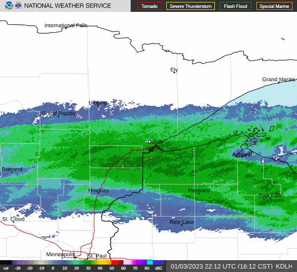
WSR-88D radar from the National Weather Service in Duluth, MN
and valid from 4:12 PM to 5:15 PM CST (22:12 to 23:15 UTC)
The next two loops of radar images show the northward progression of the next main band of moderate to heavy snow. The radar image loop shows some strong bands of snow affecting the cities of Duluth and Superior. The main band is farther south and extends initially from east to west from Park Falls to Hayward then to Hinckley but is moving slowly towards the north. The next loop shows the band of snow farther north extending from east to west across the lakeshore counties of northwest Wisconsin and then as farther west in Minnesota to the midpoint between Grand Rapids and Brainerd. The northern fringes of the band is over Duluth. This band just pounded the area with heavy snow for an extended period of time, especially south of Duluth.
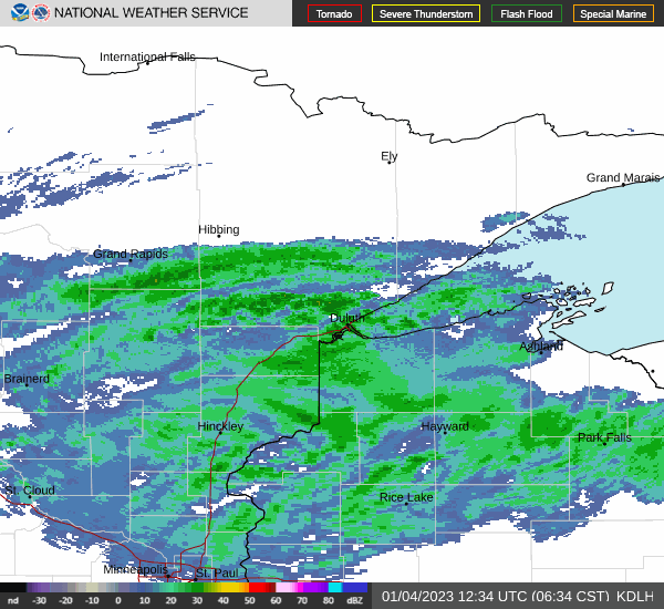
WSR-88D radar from the National Weather Service in Duluth, MN
and valid from 6:34 AM to 7:36 AM CST (12:34 to 13:36 UTC)
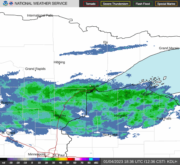
WSR-88D radar images from the National Weather Service in Duluth, MN
and valid from 12:36 PM to 1:40 PM CST (18:36 to 10:40 UTC)
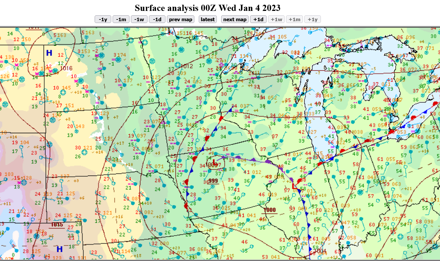
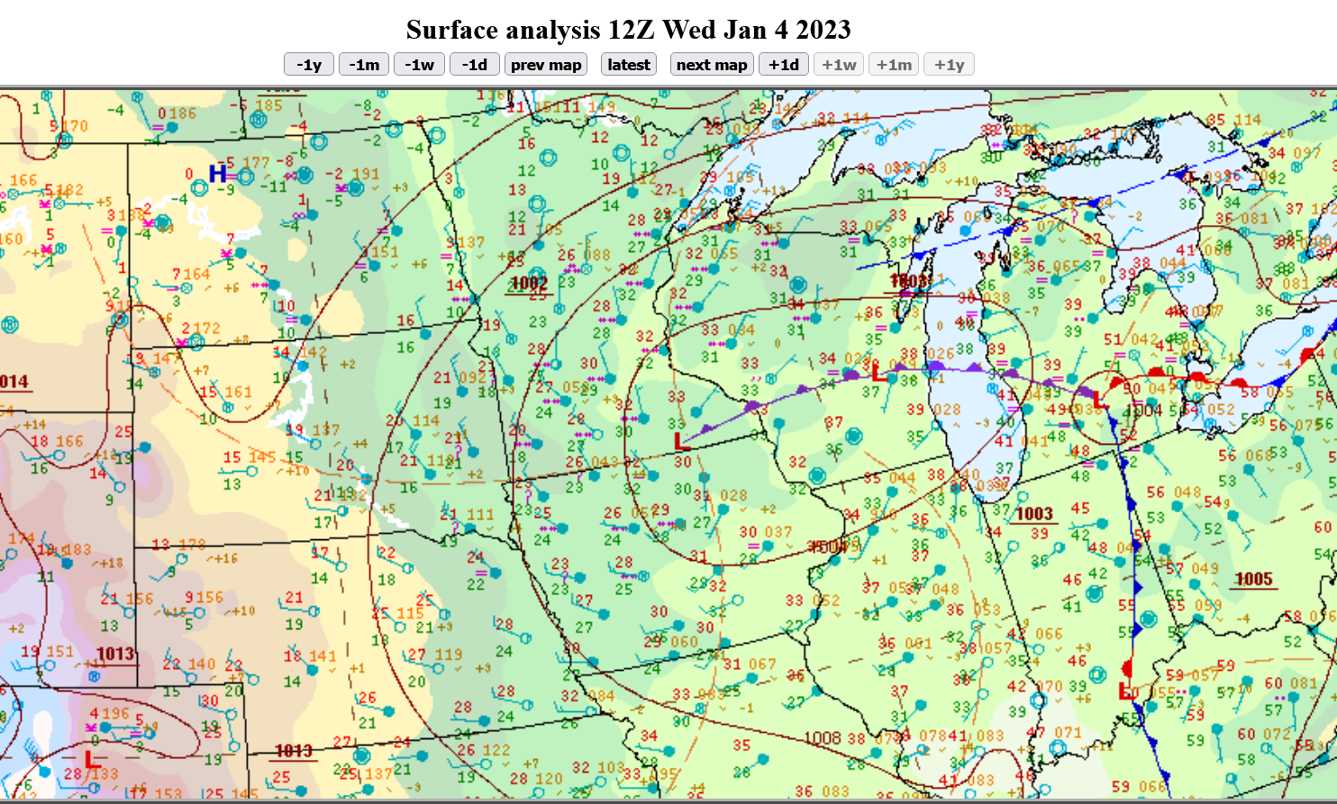
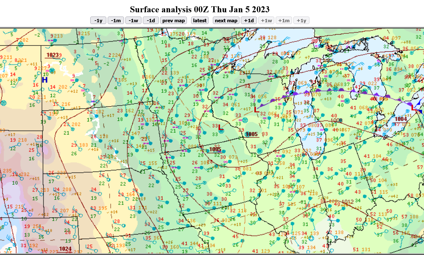
Surface maps
The following sequence of surface maps shows how the low pressure system was moving slowly northeast through Iowa then stalled in southeast Minnesota to prolong the snow and boost the accumulations. The maps are sourced from the Weather Prediction Center unit of the National Weather Service. The time and date labels that are already part of the images are in Coordinated Universal Time (UTC). The Central Standard Time (CST) equivalents are added at the bottom of each image. UTC is six hours ahead of CST so some of the dates will be different.
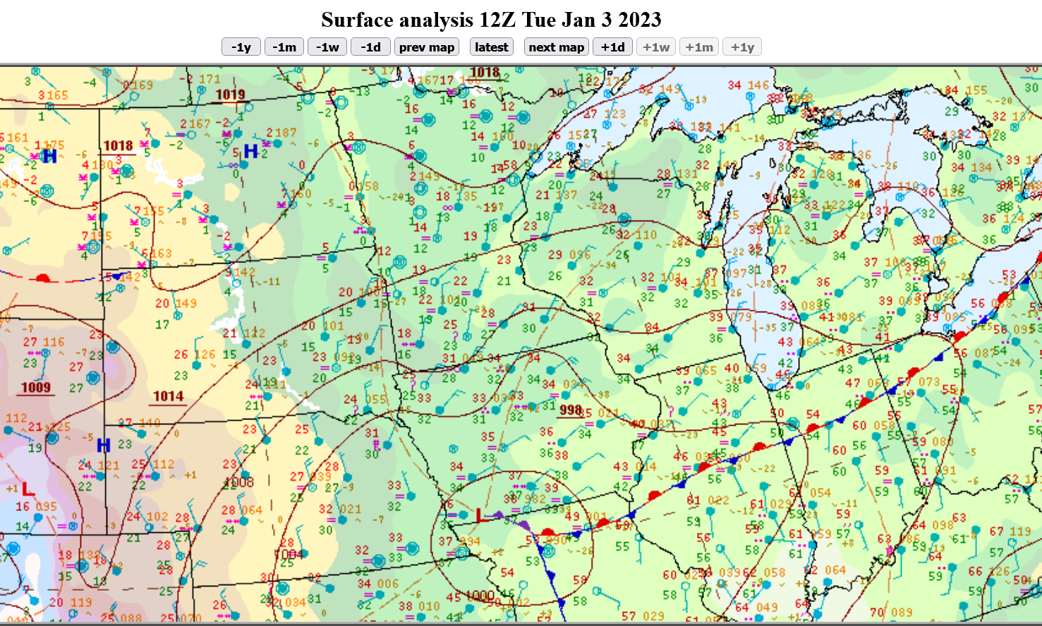
6 AM CST Tuesday January 3 2023
6 PM CST Tuesday January 3 2023
6 AM CST Wednesday January 4 2023
6 PM CST Wednesday January 4 2023
References and data sources
National Weather Service Forecast Office Duluth, MN - Radar images and snowfall reports
National Weather Service Forecast Office Twin Cities/Chanhassen, MN - Snowfall reports
Weather Prediction Center of the National Weather Service - High resolution surface maps