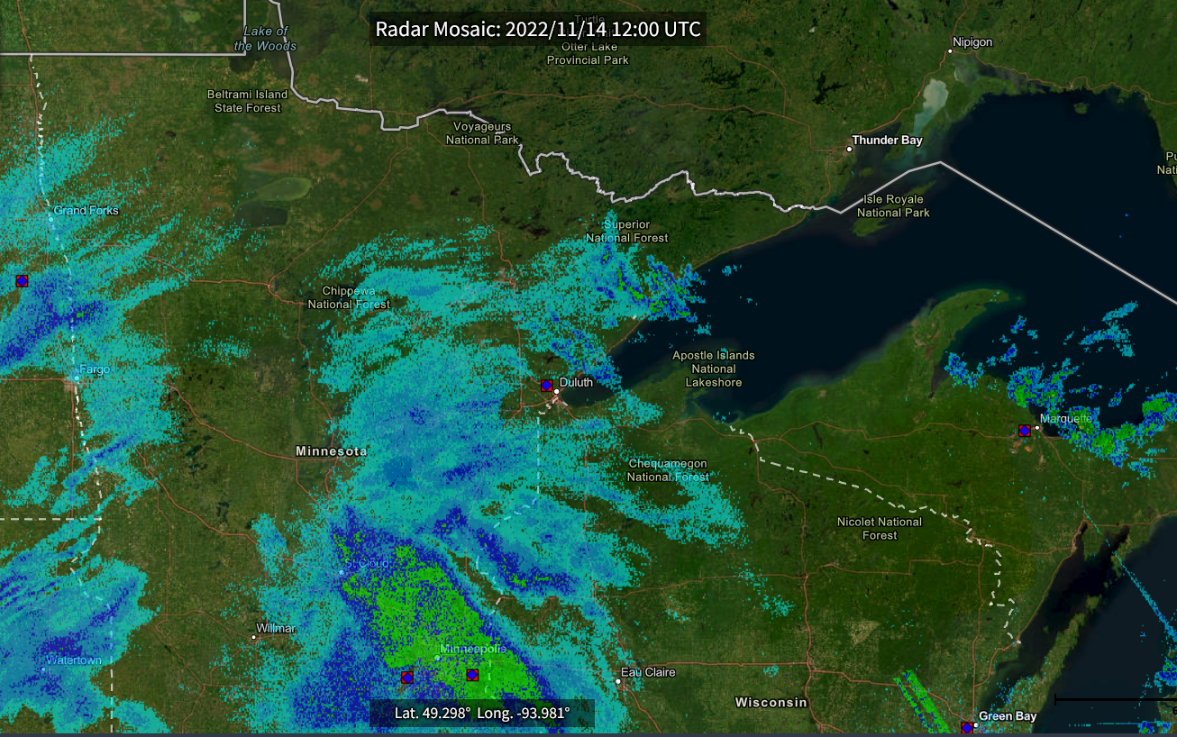
Radar Mosaic from the National Centers for Environmental Information
A long duration light snow event turned into a much more impressive event due to enhancement from Lake Superior. Bands of snow from the lake primarily affected the near shore areas of Lake County, Minnesota and extending northeast through near shore areas of Cook County, Minnesota. In Cook County heavier snow extended farther inland across the east half of the county. Duluth also received some lake effect but the contribution was much weaker. Overall, light snow fell across the region from early Monday morning, November 14 before daybreak to late afternoon and early evening Wednesday, November 16 based on Central Standard Time (CST). More light snow moved into east-central and northeast Minnesota later in the night after midnight early early Thursday morning but was from another clipper-like low pressure system moving southeast out of southern Manitoba, Canada.
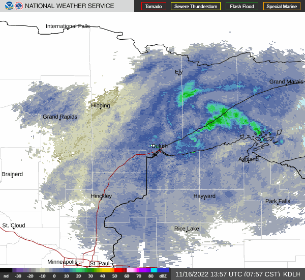
The first radar image is taken from early in the event and is valid for 6 AM CST, Monday, November 14 (12:00 UTC). A large area of light snow was spreading northeast into northeast Minnesota and northwest Wisconsin. Bands of Lake Effect snow oriented southeast to northwest can be seen moving onto the north shore of Lake Superior. Some of the lake effect snow occurring in far eastern Cook County is likely out of radar range as the radar would be overshooting tops of the lake generated clouds. The second radar image is an animation that shows the rotation of a mesolow perhaps to some extent a lake vortex. The radar animation images range from 7:57 AM CST to 9:45 AM CST. The mesolow is producing heavier snow in Lake County especially along the shoreline. Interesting to note is that the Area Forecast Discussion issued at 4:01 PM CST Tuesday, November 15 by the National Weather Service Forecast Office in Duluth mentioned that some of the high resolution forecast model guidance showed the potential for the mesolow to develop.
National Weather Service weather spotter and cooperative observer reports showed that generally 3 to 5 inches fell over much of east-central and northeast Minnesota and northwest Wisconsin. Duluth received between 6 and 9 inches, at least in the higher terrain. The big winners by far, depending on your sentiment, were the aforementioned portions of Cook County and Lake County with 15 to 30 inches. Victims included the Silver Bay area in Lake County and the Grand Marais vicinity in Cook County.
National Weather Service Forecast Office Duluth, MN - Radar images, Area Forecast Discussion, and snowfall reports
National Centers for Environmental Information (NCEI) - Radar mosaic