7:43 AM CST to 9:02 AM CST, December 3, 2013
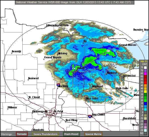
The radar loop shows heavier snow attached to the higher terrain over Duluth and northeast along the north shore of Lake Superior. A deep layer of east to east-southeast winds from the surface through 700 millibars (roughly between 9500 and 10000 feet) resulted in the enhanced snow.