HOME
Back to Images
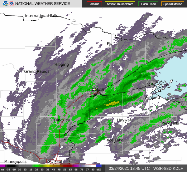
Doughnut Hole, March 24, 2021
Radar image and radar animation show a rotation feature (vortex) that looks like a doughnut.
Radar mosaic from the National Centers for Environmental
Information zoomed in on western tip of Lake Superior
and Duluth, MN on March 24, 2021

National Weather Service radar loop, Duluth, MN
ending 1:37 PM CST (2:37 CDT), March 24, 2021