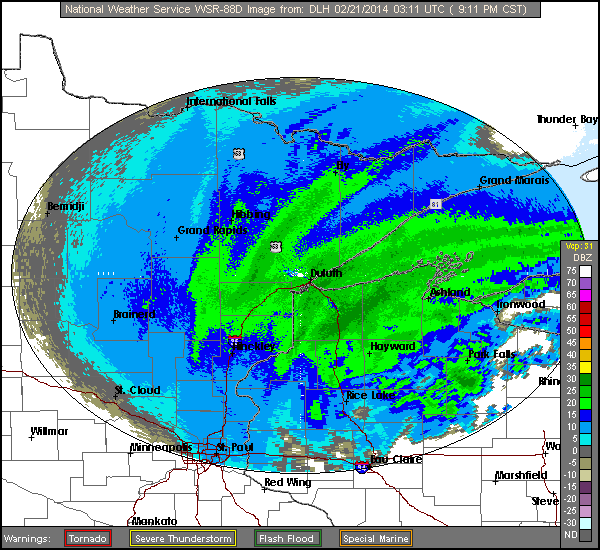
National Weather Service Duluth, MN
The following maps show the track and intensification of the storm. The 500 mb pressure level maps are used to show the upper air features of the storm.
Surface maps from the Weather Prediction Center's surface map archive
6:00 AM CST, February 20, 2014 (12:00 UTC, February 20)

12:00 PM CST, February 20, 2014 (18:00 UTC, February 20)

6:00 PM CST, February 20, 2014 (00:00 UTC, February 21)

12:00 AM CST, February 21, 2014 (06:00 UTC, February 21)

6:00 AM CST, February 21, 2014 (12:00 UTC, February 21)

500 mb maps from the Storm Prediction Center's upper air map archive
6:00 AM CST, February 20, 2014 (12:00 UTC, February 20)

6:00 PM CST, February 20, 2014 (00:00 UTC, February 21)

6:00 AM CST, February 21, 2014 (12:00 UTC, February 21)
